Global Land One-kilometer Base Elevation
GISWiki - Das freie Portal für Geoinformatik (GIS)
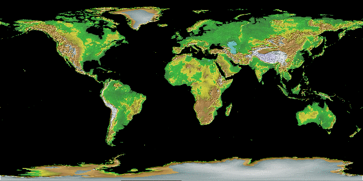
GLOBE ist ein digitales Höhenmodell, das international entworfen und entwickelt wurde. Die GRID-Breite/Höhe beträgt 30 Bogensekunden.
Das laufende Projekt sammelt Daten aus verschiedenen Datensätzen, um eine umfassende hohe Qualität zu erreichen. Wichtige Teile wurden dem GTOPO30 entnommen, aber es gibt Regionen, die aus anderen Datensätzen stammen. GLOBE bietet zwei Datenmsätze verschiedener Qualität:
- G.O.O.D. (Globally Only Open-access Data, uneingeschränkte Nutzung) und
- B.A.D. (Best Available Data, Nutzungsbeschränkungen für bestimmte Regionen).
Weblinks