Geodaten Weltweit: Unterschied zwischen den Versionen
GISWiki - Das freie Portal für Geoinformatik (GIS)
HeinzJ (Diskussion | Beiträge) |
HeinzJ (Diskussion | Beiträge) (→Weltweit) |
||
| (Eine dazwischenliegende Version desselben Benutzers wird nicht angezeigt) | |||
| Zeile 1: | Zeile 1: | ||
==Weltweit == | ==Weltweit == | ||
| + | |||
| + | <DPL> | ||
| + | category=Geodaten | ||
| + | category=Erde | ||
| + | ordermethod=lastedit | ||
| + | order=ascending | ||
| + | </DPL> | ||
* '''[[VMAP]]''' ('''Vector Map'''), ein weltweites vektor-basiertes topographisch-kartographisches Informationssystem der NATO, das von der National Geospatial-Intelligence Agency, der militär-geographischen Behörde der USA, herausgegeben wird. VMAP Level 0 (entspricht etwa dem Maßstab 1:1.000.000) ist frei verfügbar. | * '''[[VMAP]]''' ('''Vector Map'''), ein weltweites vektor-basiertes topographisch-kartographisches Informationssystem der NATO, das von der National Geospatial-Intelligence Agency, der militär-geographischen Behörde der USA, herausgegeben wird. VMAP Level 0 (entspricht etwa dem Maßstab 1:1.000.000) ist frei verfügbar. | ||
| Zeile 5: | Zeile 12: | ||
* '''[[Digital Chart of the World|DCW (Digital Charts of the World)]]''' | * '''[[Digital Chart of the World|DCW (Digital Charts of the World)]]''' | ||
** [http://www.maproom.psu.edu/dcw/ Download] | ** [http://www.maproom.psu.edu/dcw/ Download] | ||
| − | ** [http://216.15.110.75/downloads/DCW/DCW_data/ Download im Manifold-Format] | + | ** [http://216.15.110.75/downloads/DCW/DCW_data/ Download im Manifold-Format] (tot) |
| − | + | ||
| − | + | ||
* '''[http://www.ngdc.noaa.gov/ NOAA's National Geophysical Data Center (NGDC)]'''<br>NOAA's National Geophysical Data Center (NGDC) provides scientific stewardship, products, and services for geophysical data from the Sun to the Earth and Earth's sea floor and solid earth environment, including Earth observations from space. | * '''[http://www.ngdc.noaa.gov/ NOAA's National Geophysical Data Center (NGDC)]'''<br>NOAA's National Geophysical Data Center (NGDC) provides scientific stewardship, products, and services for geophysical data from the Sun to the Earth and Earth's sea floor and solid earth environment, including Earth observations from space. | ||
| Zeile 39: | Zeile 44: | ||
{{Seite|The University of Texas at Austin - Geodata Worldwide}} | {{Seite|The University of Texas at Austin - Geodata Worldwide}} | ||
* The worldwide index of cities and towns at '''http://www.fallingrain.com/world/''' . | * The worldwide index of cities and towns at '''http://www.fallingrain.com/world/''' . | ||
| − | |||
| − | |||
| − | |||
| − | |||
| − | |||
| − | |||
| − | |||
[[Kategorie:Geodaten]] | [[Kategorie:Geodaten]] | ||
[[Kategorie:Erde]] | [[Kategorie:Erde]] | ||
Aktuelle Version vom 11. Januar 2008, 18:34 Uhr
Weltweit
<DPL> category=Geodaten category=Erde ordermethod=lastedit order=ascending </DPL>
- VMAP (Vector Map), ein weltweites vektor-basiertes topographisch-kartographisches Informationssystem der NATO, das von der National Geospatial-Intelligence Agency, der militär-geographischen Behörde der USA, herausgegeben wird. VMAP Level 0 (entspricht etwa dem Maßstab 1:1.000.000) ist frei verfügbar.
- NOAA's National Geophysical Data Center (NGDC)
NOAA's National Geophysical Data Center (NGDC) provides scientific stewardship, products, and services for geophysical data from the Sun to the Earth and Earth's sea floor and solid earth environment, including Earth observations from space.
- Kartenserver der Firma Demis
Laut Demis unterliegen diese Karten keinem Urheberrecht bzw. sind Public Domain. Zitat: Each of these databases is considered "public domain", there are no known copyright restrictions on the use of this data.
- http://earthobservatory.nasa.gov/Newsroom/BlueMarble/
The Blue Marble is the most detailed image of the Earth, and you can download it it for free at resolutions up to 8192 by 4096.
- ESRIs Geography Network - Online Portal zur Recherche von freien Daten (für Europa/Deutschland nur eingeschränkt)
- GEOnet Names Server (GNS)
- The GEOnet Names Server (GNS) provides access to the National Geospatial-Intelligence Agency's (NGA) and the U.S. Board on Geographic Names' (US BGN) database of foreign geographic feature names. The database is the official repository of foreign place-name decisions approved by the US BGN. Approximately 20,000 of the database's features are updated monthly.
- Geographic Area of Coverage: Worldwide excluding the United States and Antarctica. For names in the U.S. and Antarctica, visit the United States Geological Survey (USGS) Geographic Names Information System (GNIS) web site.
- The GNS contains 4.0 million features with 5.5 million names (approximate).
- The coordinate system for data served by GNS is WGS84.
- Coordinates in the GEOnet Names Server are approximate and are intended for finding purposes only.
- The online database is updated on a bi-weekly schedule.
- Geonames.org vereint frei Geodaten aus diversen Quellen. Verfügbar als Webservice oder Download. Korrekturmöglichkeiten mittels Wiki.
- The University of Texas at Austin
- Physical Maps / Physische Geographie
- Physical Map of the World 2005 (6MB) [pdf format]
- Physical Map of the World 2004 (4.18MB) [pdf format]
- Physical Map of the World 2003 (2.3MB) [jpeg format]
- Physical Map of the World 1999 (2.1MB) [pdf format]
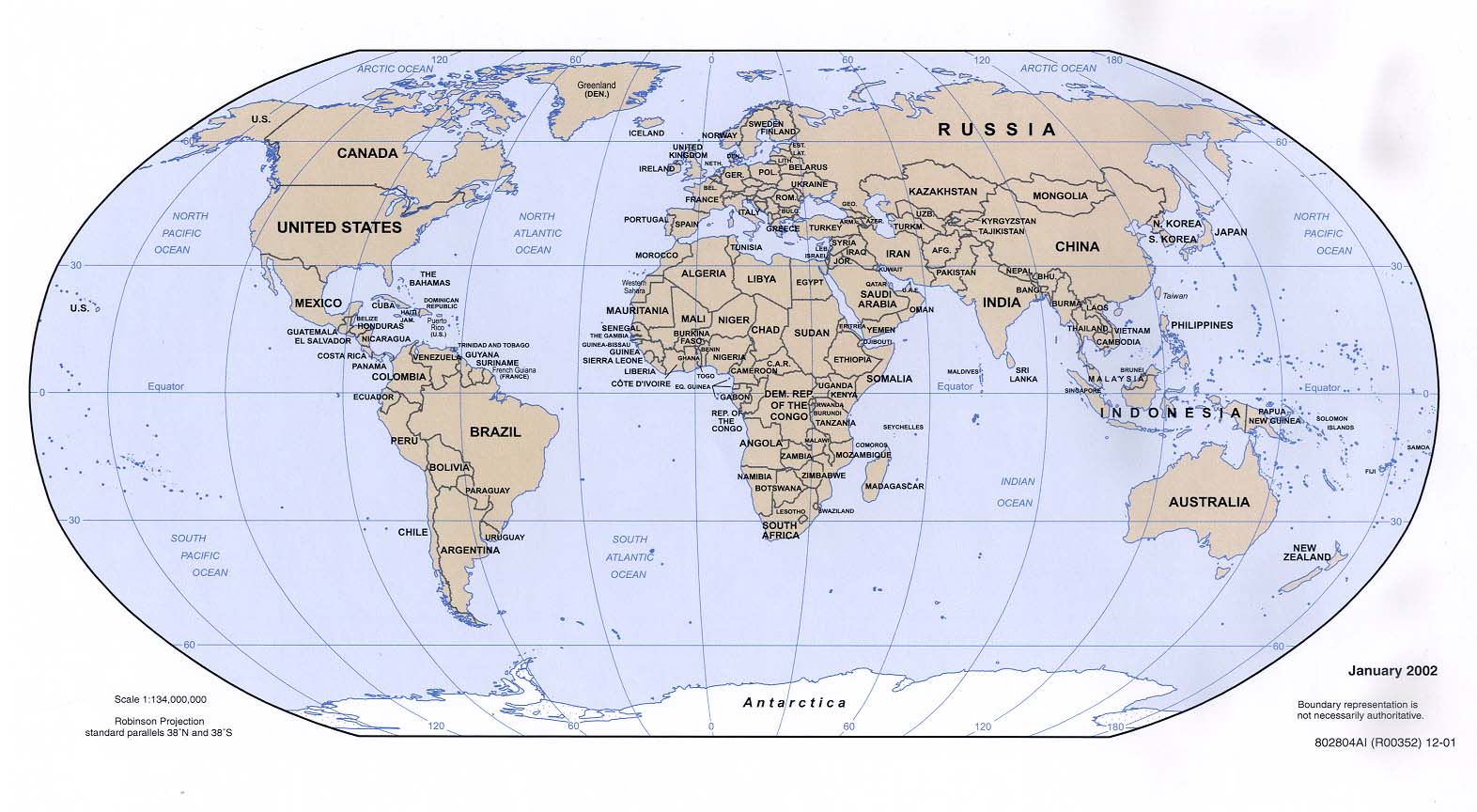
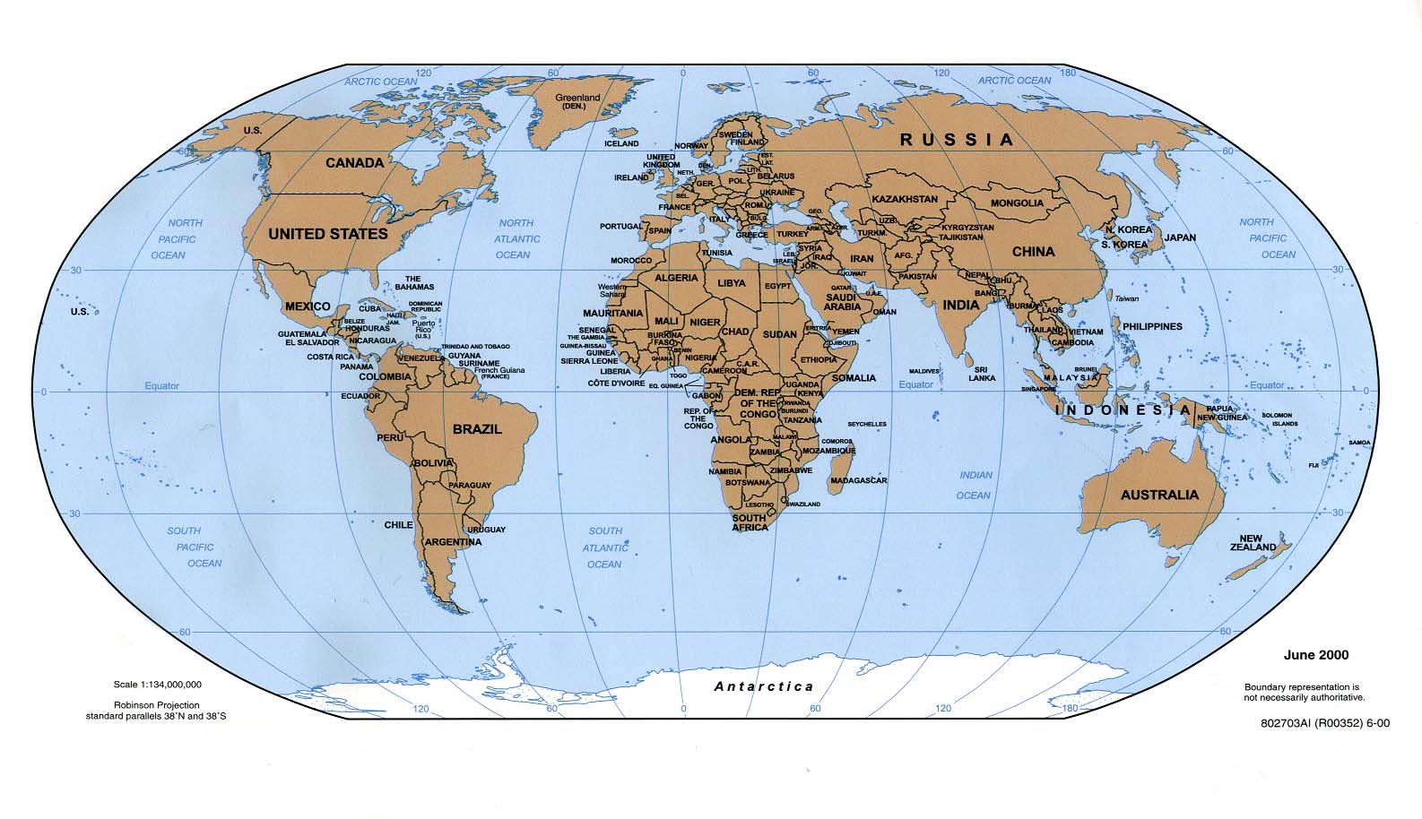
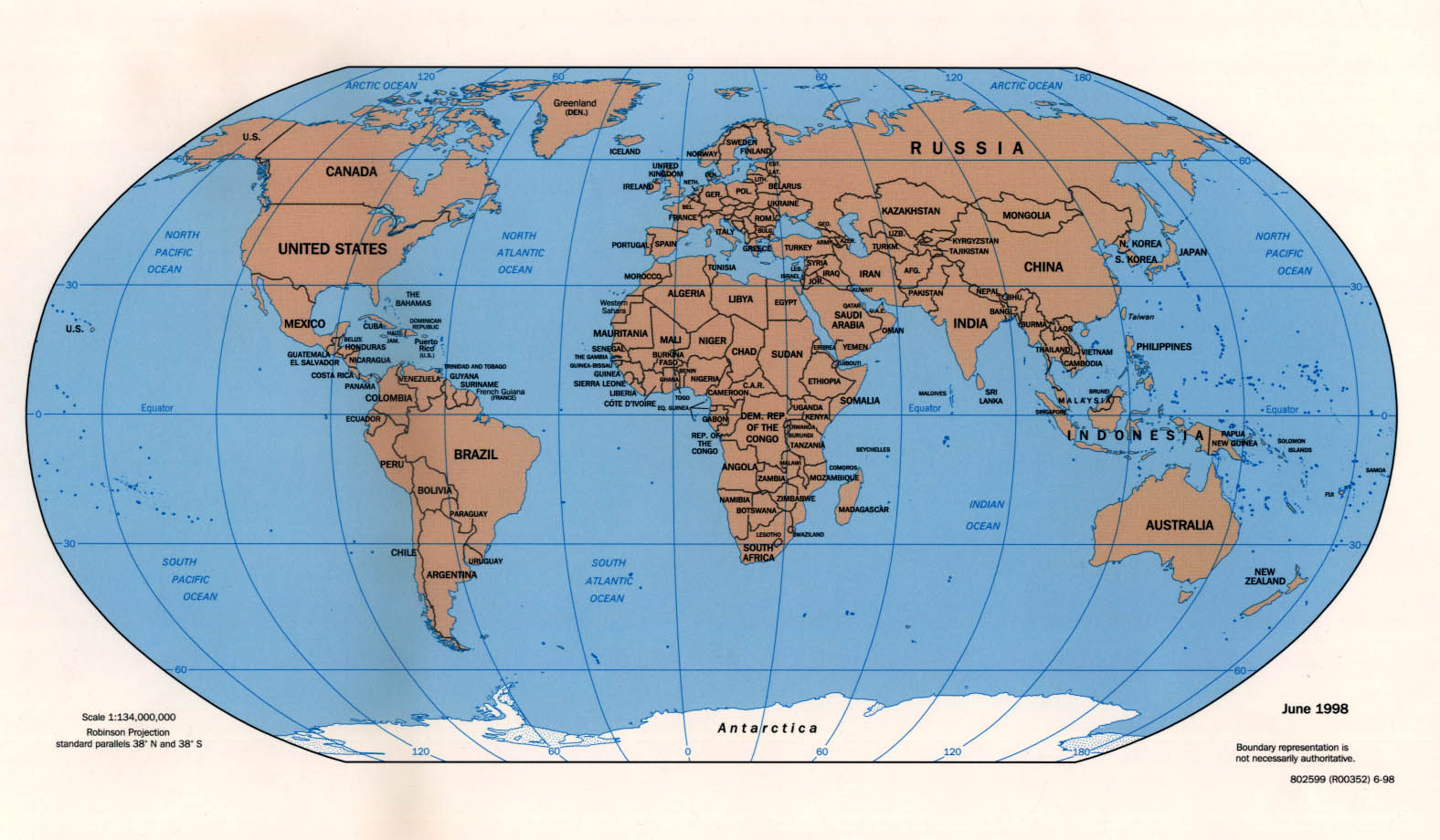
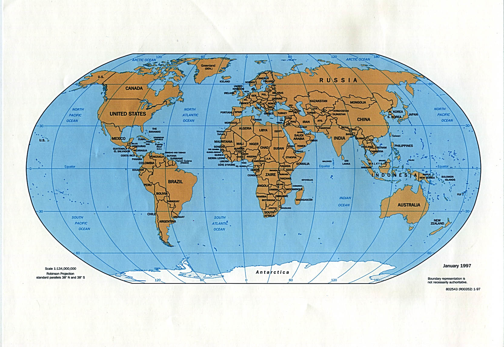
- Political Maps / Politische Karten
- World Map (Political) 2005 (1.8MB) [pdf format]
- World Map (Political) 2004 (1.76MB) [pdf format]
- World Map (Political) 2002 (187K) and [world_maps/world_pol02.pdf pdf format] (193K)
- World Map (Political) 2001 (4MB) [pdf format]
- World Map (Political) 2000 (197K) and [world_maps/world_pol_2000.pdf pdf format] (203K)
- World Map (Political) 1999 (2.1MB) [pdf format]
- World Map (Political) 1998 (323K) and [world_maps/world_pol_1998.pdf pdf format] (217K)
- World Map (Political) [countries in multi-colors] 1998 (MrSID format) (Link to Library of Congress)
- World Map (Political) 1997 (315K) and [world_maps/world_pol_1997.pdf pdf format] (310K)
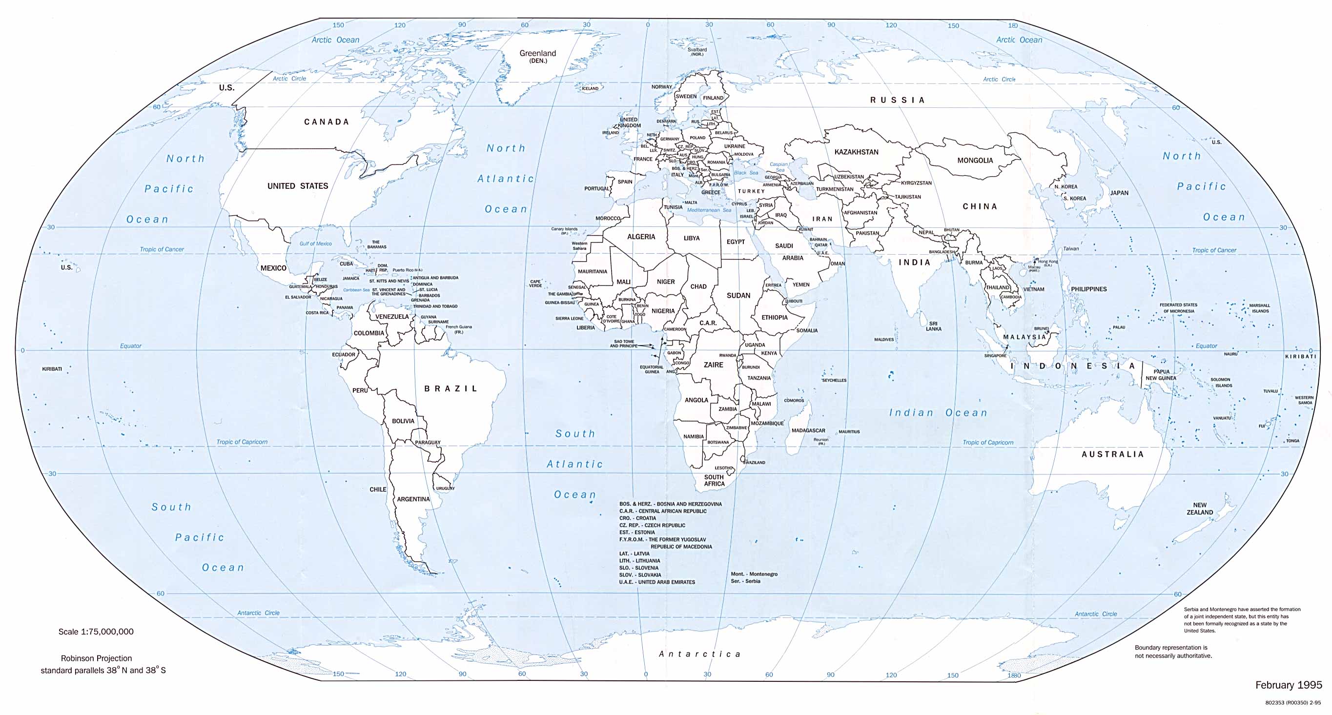
- World Map (Political) February 1995 (360K) and [world_maps/world_pol_feb_1995.pdf pdf format] (364K)
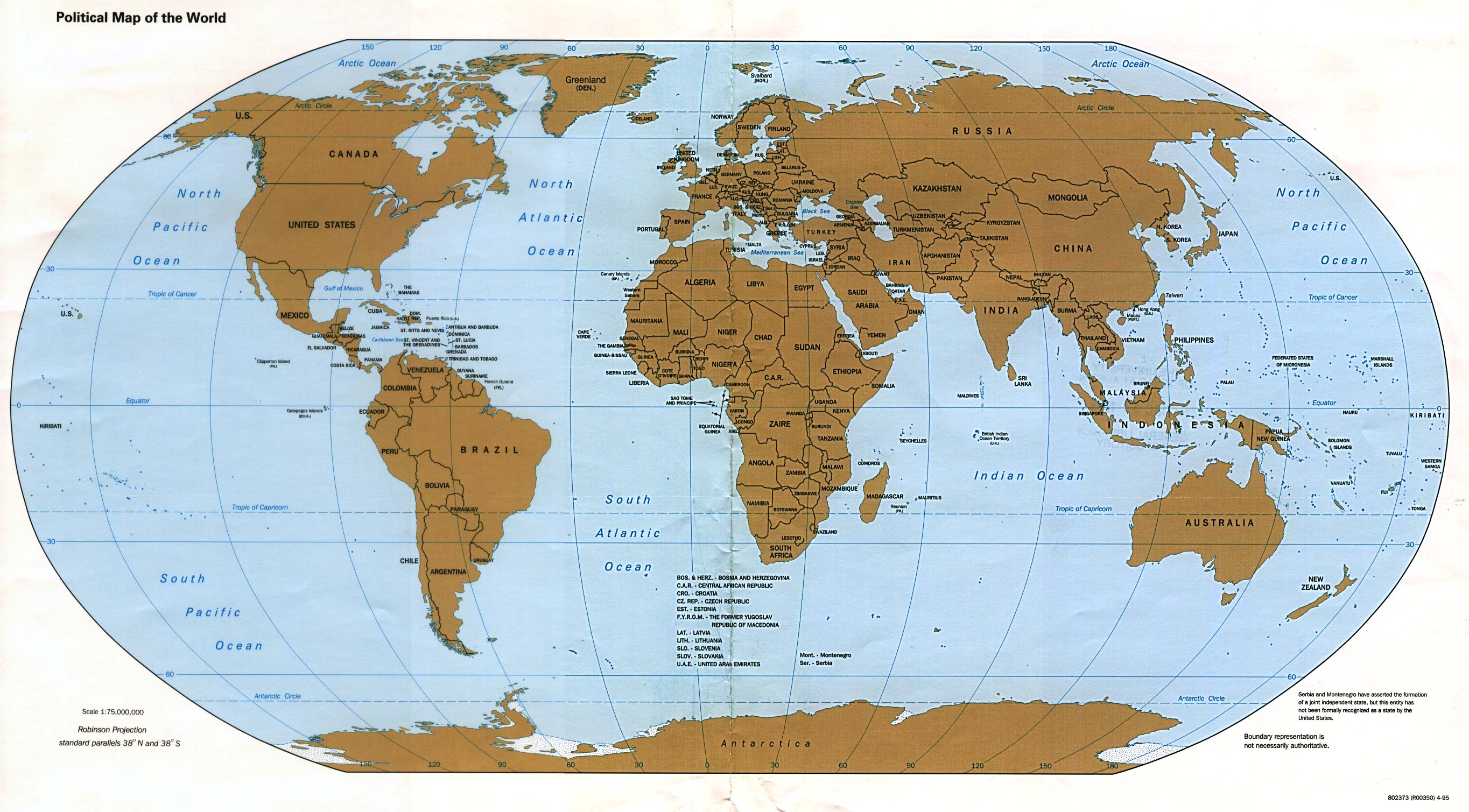
- World Map (Political) April 1995 (588K) and [world_maps/world_pol_april_1995.pdf pdf format] (591K)
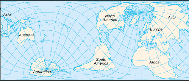
- World Map (Small Map) 2005 (27K)
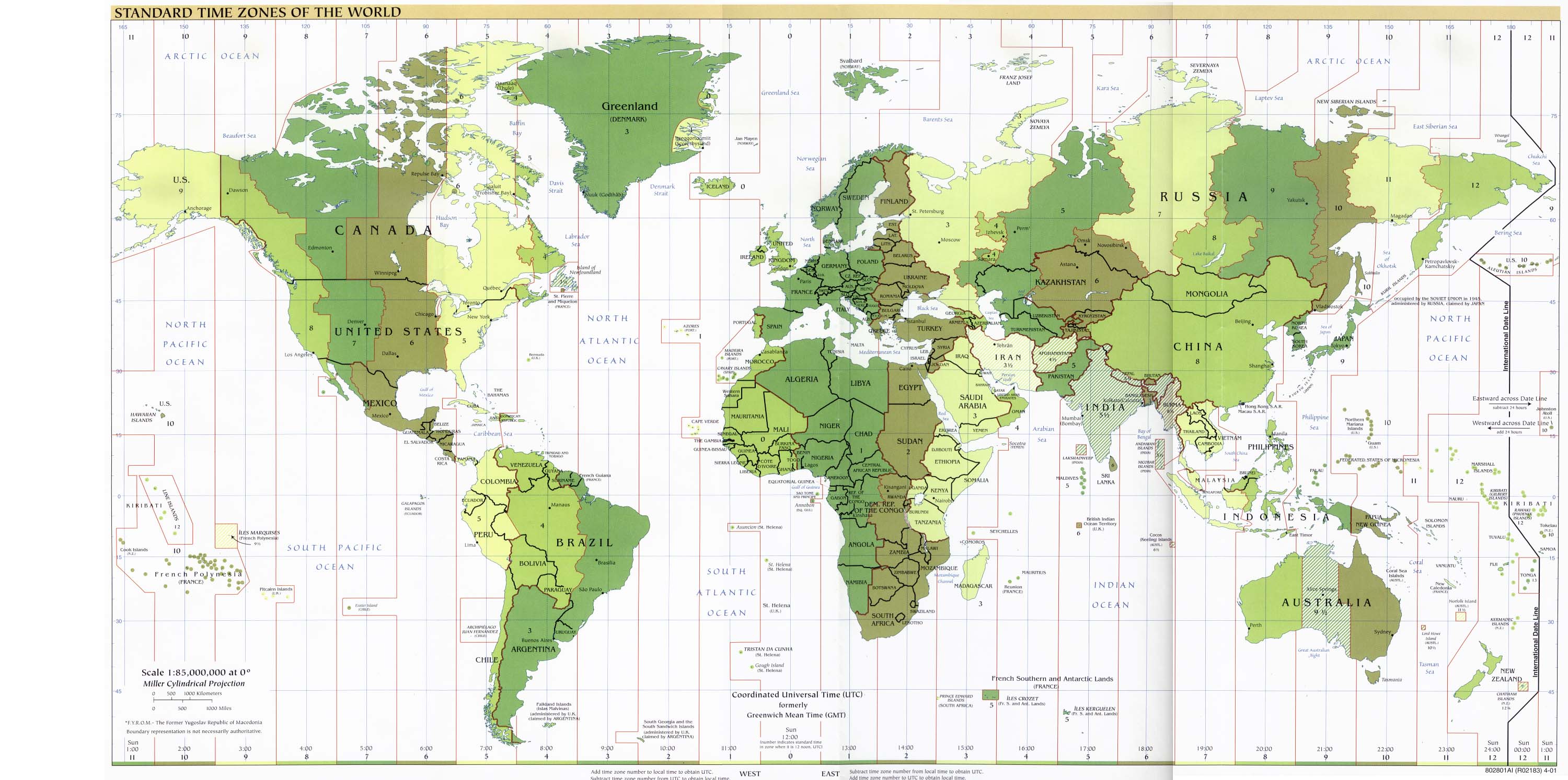
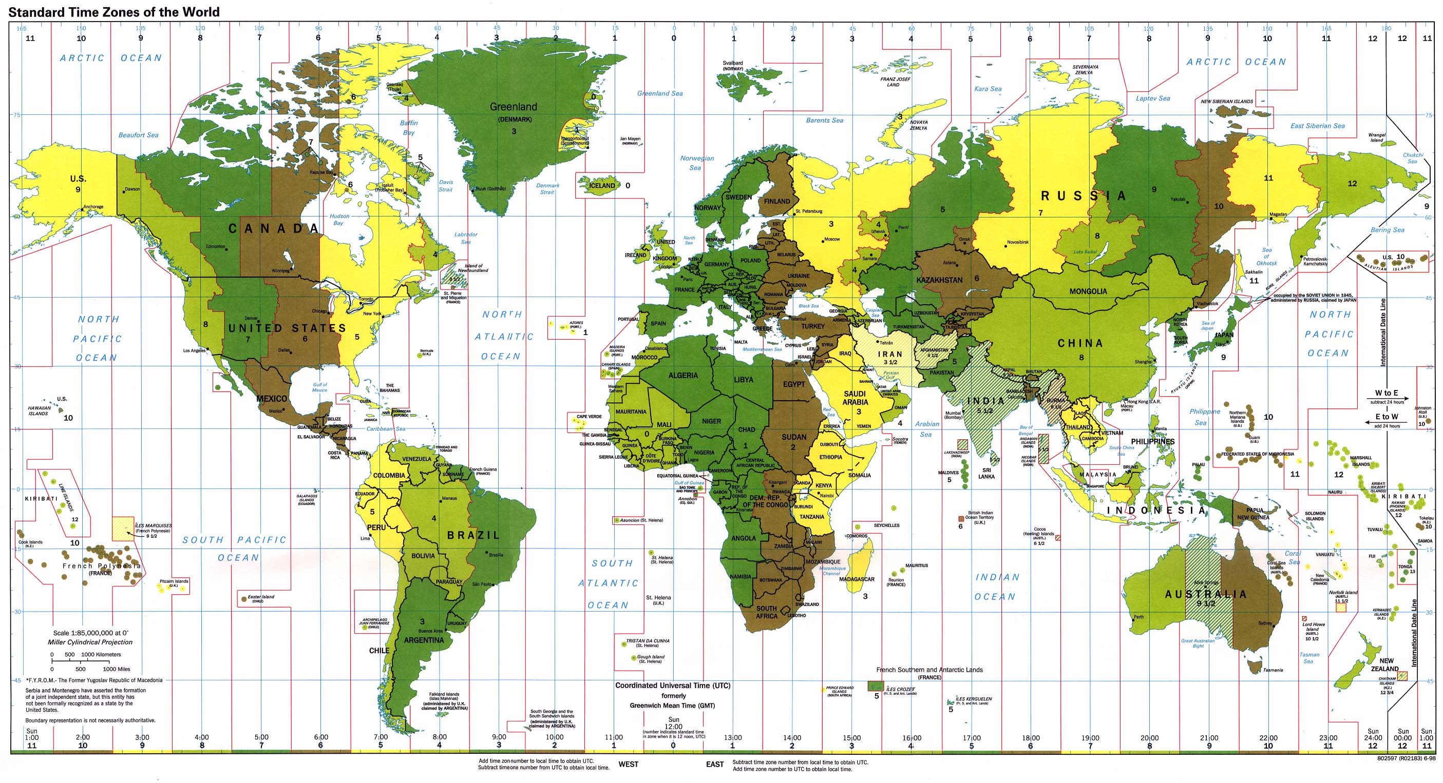
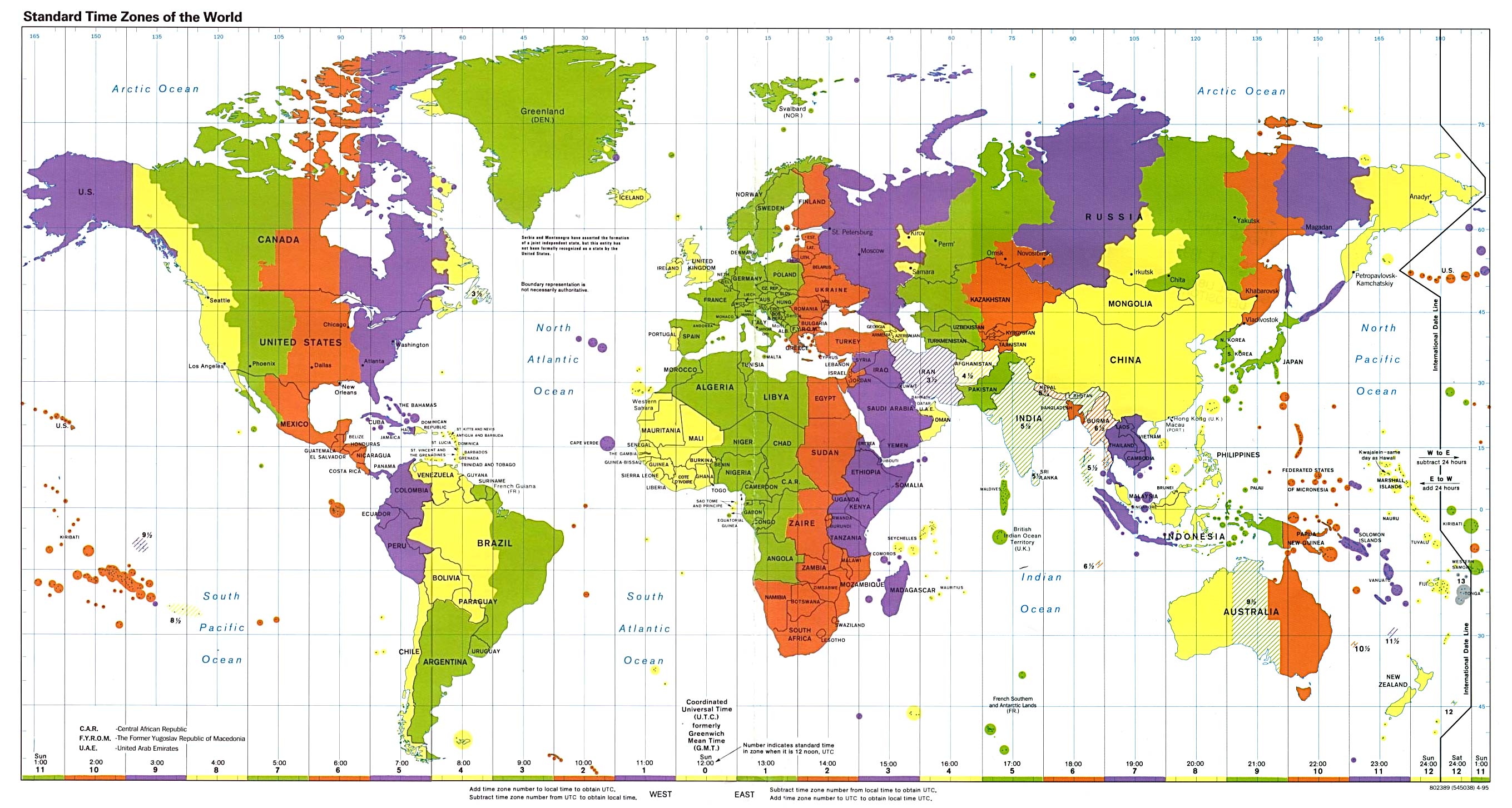
- Standard Time Zones of the World
- Standard Time Zones of the World 2005 (824K) [pdf format]
- Standard Time Zones of the World 2004 (806K) [pdf format]
- Standard Time Zones of the World 2001 (515K)
- Standard Time Zones of the World 1998 (774K)
- Standard Time Zones of the World 1995 (593K)
- Standard Time Zones of the World 2001 (1.6MB) [pdf format]
- Standard Time Zones of the World 2000 (1.2MB) [pdf format]
- Standard Time Zones of the World 1999 (2.1MB) [pdf format]
- Standard Time Zones of the World 1997 (2.6MB) [pdf format]
- Further Maps / Weitere Karten
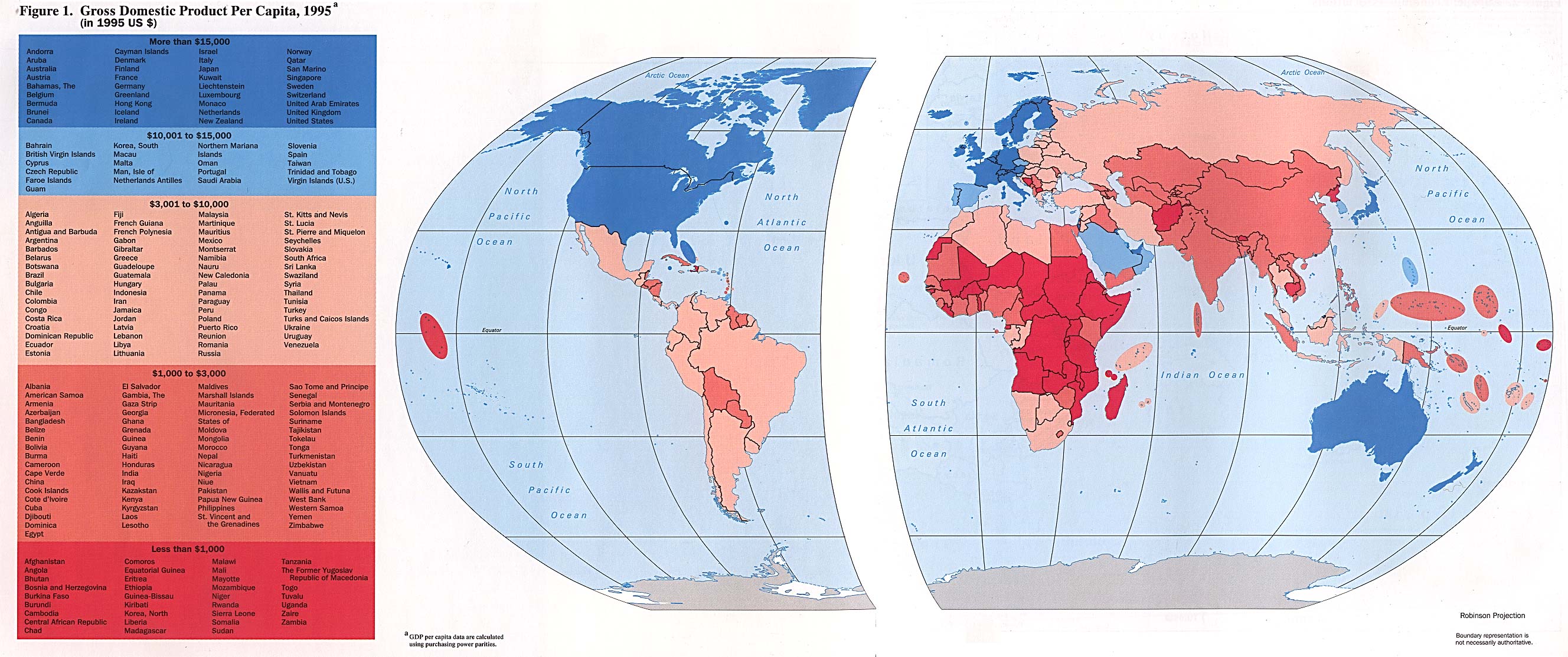
- Gross Domestic Product Per Capita from Handbook of International Economic Statistics. 1996 (546K)
- Historical Maps of the World (University of Texas Map Collection)
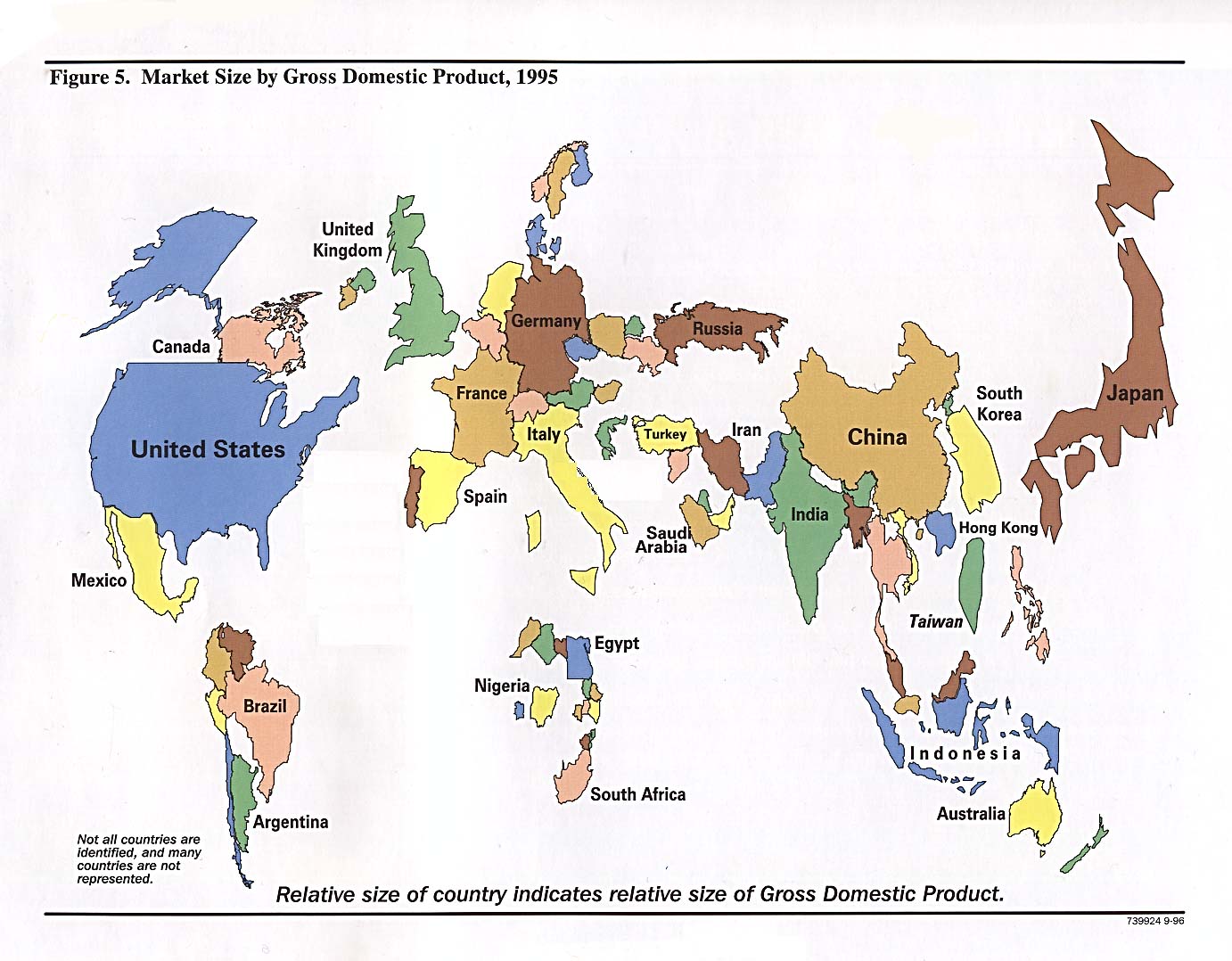
- Market Size By Gross Domestic Product from Handbook of International Economic Statistics. 1996 (215K)
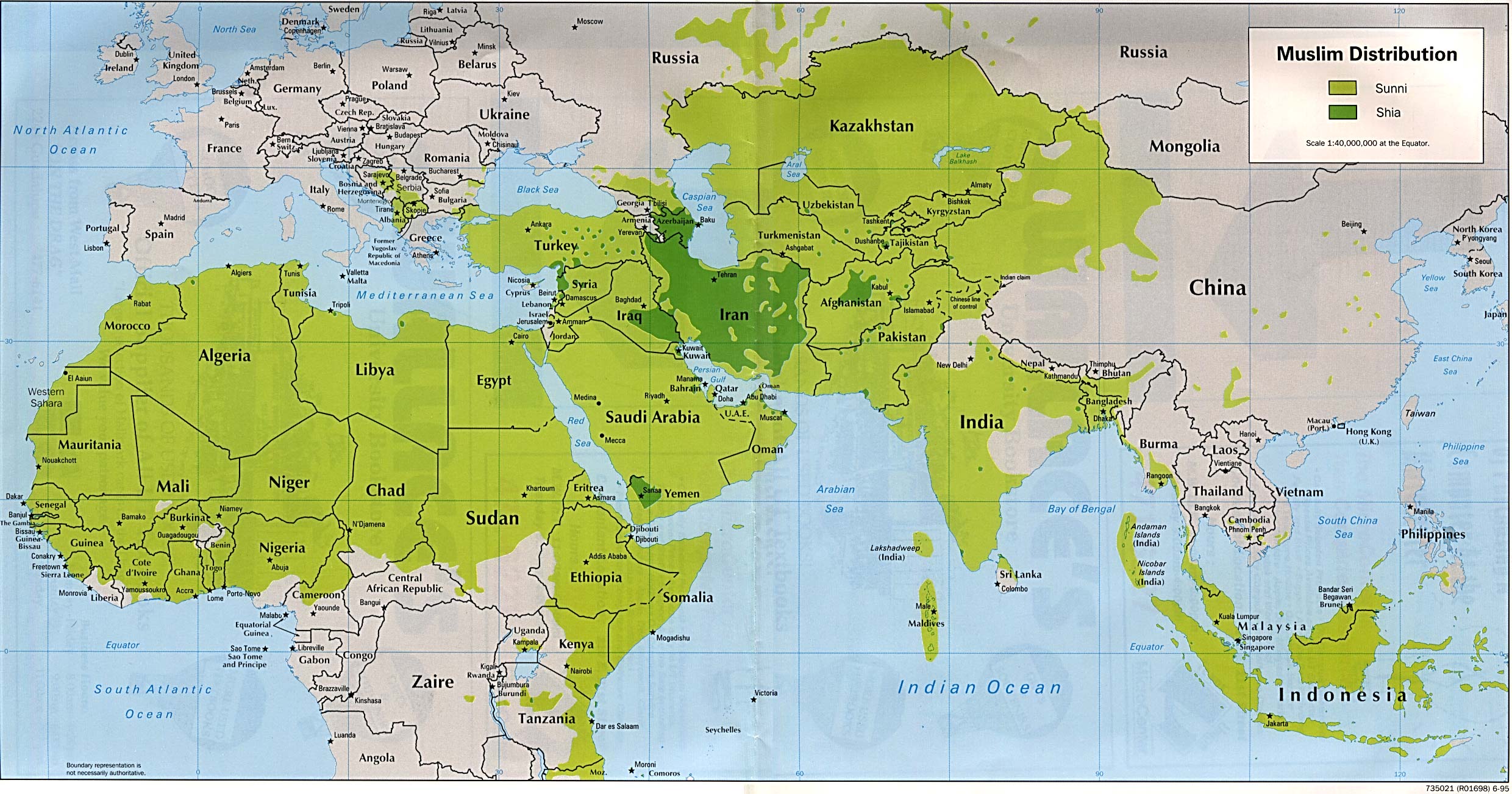
- Muslim Distribution (Sunni and Shia) 1995 (557K)
- Ocean Currents and Sea Ice from Atlas of World Maps. United States Army Service Forces, Army Specialized Training Division. Army Service Forces Manual M-101. 1943 (583K)
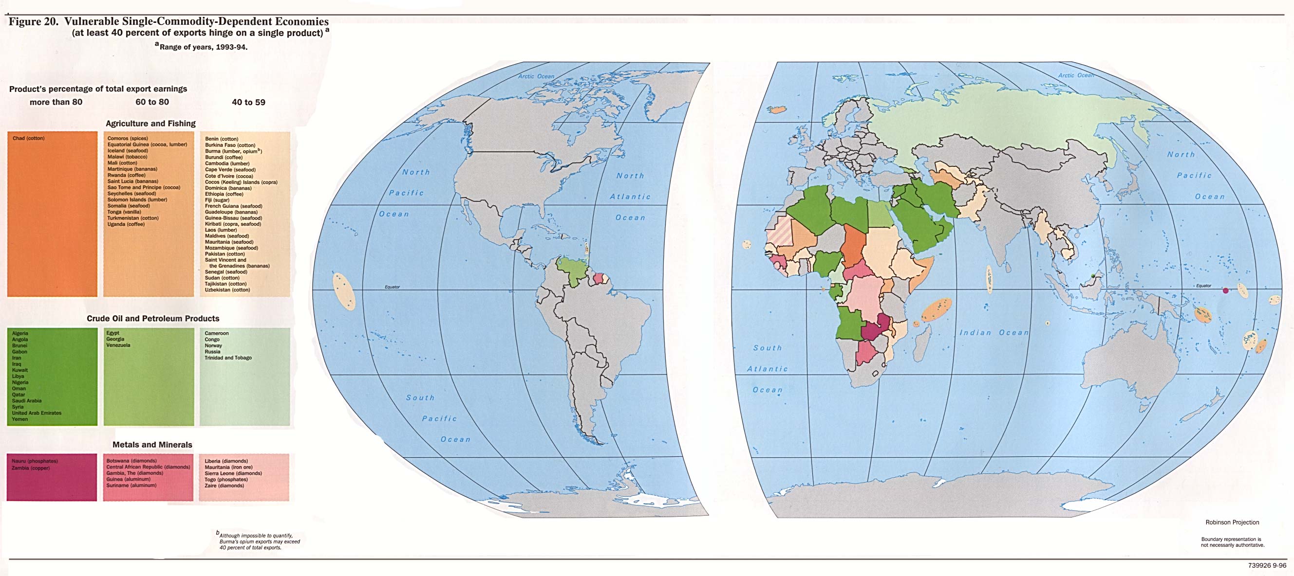
- Vulnerable Single-Commodity-Dependent Economies from Handbook of International Economic Statistics. 1996 (390K)
- World City Maps (University of Texas Map Collection)
- World City Maps on Other Web Sites
- World Country Maps (Small Maps) from The World Factbook, published by the U.S. Central Intelligence Agency:
- The worldwide index of cities and towns at http://www.fallingrain.com/world/ .